
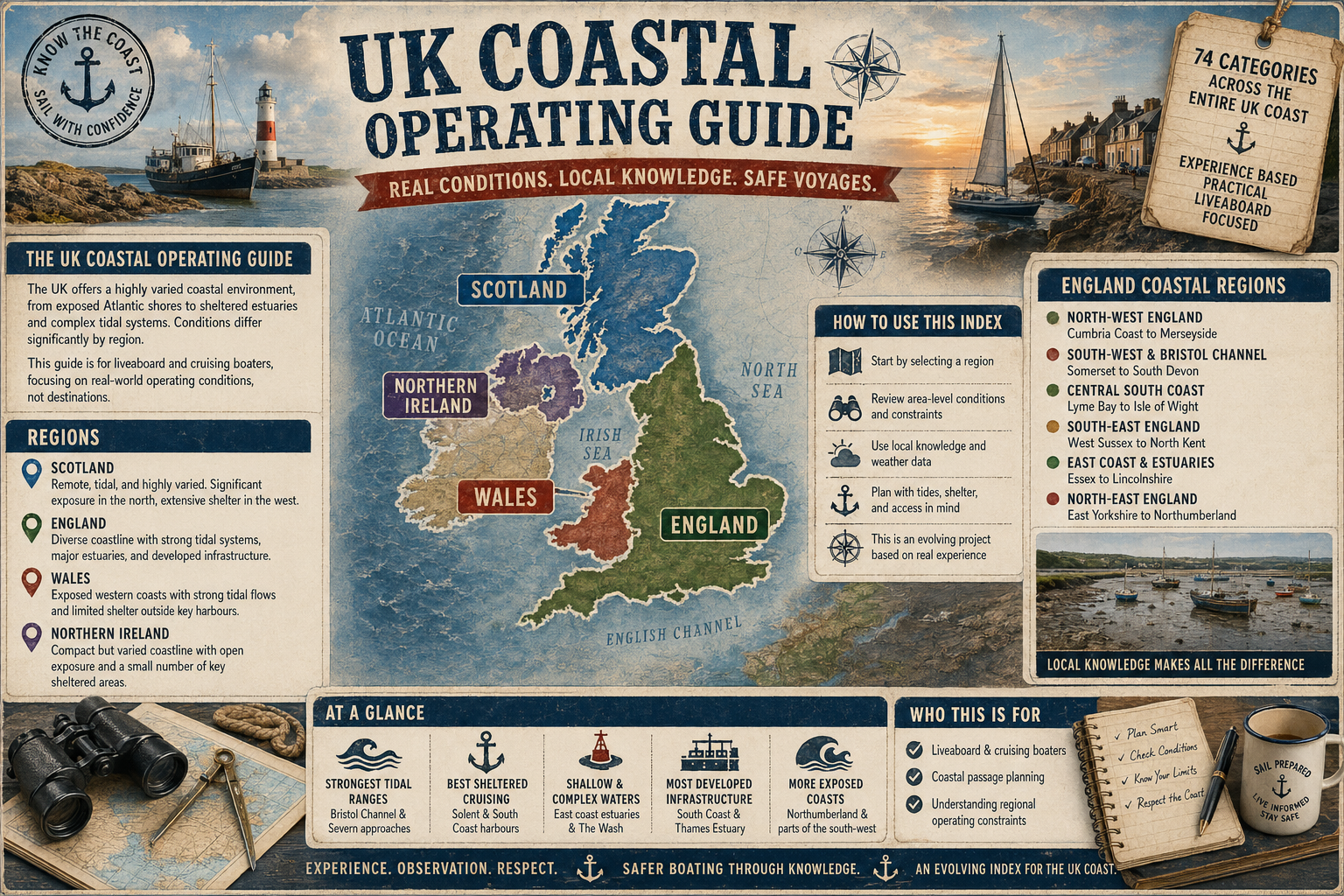


The Norfolk Coast, facing the North Sea from Hunstanton to Winterton and enclosing the low-lying reaches of The Wash, carries a long-standing regional association with the figure known as Black Shuck. In local tradition this is described as a large black dog, sometimes recorded as appearing along lanes, churchyards and exposed coastal ground. The accounts are uneven in detail and origin, and are best regarded as part of East Anglian oral tradition rather than a single coherent legend.
The most frequently cited historical reference relates to reported 16th-century events during severe storms affecting coastal parishes in Norfolk and Suffolk. One such account, often linked with Blythburgh and Bungay, describes unusual atmospheric conditions during violent weather, though surviving documentation is fragmentary and interpretation remains uncertain. Whether these reports describe a singular phenomenon, misidentified natural events, or later narrative layering is not clear. What is consistent is the association of the figure with sudden weather changes and the exposed, wind-swept landscape of the East Anglian coast.
From a maritime perspective, the Norfolk shoreline provides conditions that are well suited to the persistence of such traditions. The approaches to Great Yarmouth and Lowestoft are affected by shifting sandbanks, notably the Barber Sands and other mobile shoals, while the broad tidal sweep of The Wash creates extensive intertidal flats that can become hazardous under poor visibility. Offshore, the North Sea is prone to rapid changes in wind strength and sea state, particularly with easterly and north-easterly systems that bring low cloud, drizzle and reduced horizon definition. In such conditions, visual references on land may be lost entirely from small craft operating nearshore.
It is in this context that coastal folklore such as Black Shuck is occasionally referenced by fishermen and pilots as part of a wider body of cautionary tradition. While there is no navigational function to the belief, it sits alongside practical knowledge of tides, estuary channels and sandbank movement. The River Yare, the Glaven at Blakeney, and the approaches to Wells-next-the-Sea all require careful attention to shifting depths and timing, and local seamanship has long relied on observational skill rather than fixed markers alone.
Some interpretations suggest that the figure may have been influenced by misidentification under low light or storm conditions, possibly involving livestock, large dogs, or optical distortion in rain and sea spray. However, such explanations do not fully account for the consistency of the motif across inland and coastal communities. It is more likely that the tradition developed as part of a broader regional narrative framework in which the coastline’s exposed character and unpredictable weather played a central role.
Modern navigation along the Norfolk Coast is well charted, yet the environmental conditions that shaped earlier accounts remain present. Sea fog, locally known as haar, can still reduce visibility rapidly, and shallow-draught vessels working near the shore must remain alert to tidal set and drifting sands. In this sense, the folklore is indirectly connected to practical seamanship, reflecting historical attempts to interpret a demanding coastal environment rather than providing any direct guidance.
Black Shuck, as part of Norfolk coastal tradition, therefore occupies a place within the wider cultural record of East Anglia’s maritime edge. It is best understood as a regional expression of how communities have historically described uncertainty in weather, sound and visibility along a coast that remains both productive and exposed.
The association endures not as a navigational concern, but as a cultural footnote to a coastline defined by shallow seas, shifting channels and rapidly changing North Sea conditions.

Comments