




Lough Foyle Coast
Overview
Lough Foyle is a broad tidal estuary situated between County Londonderry and County Donegal, opening northwards into the North Atlantic. The coastline is characterised by low-lying shores, intertidal flats, and gradual transitions between river and sea conditions.
The area forms part of a larger estuarine system fed by several rivers, with a mix of sheltered inner waters and more exposed outer approaches. Its scale and openness mean that conditions can vary noticeably depending on weather patterns and tidal movement.
Local Operating Context (for Liveaboard Boaters)
For liveaboard boaters, Lough Foyle presents a largely open environment with relatively few natural constraints but also limited enclosed shelter. The wide expanse of water allows for ease of movement, though navigation requires attention to shifting channels and shallow margins.
Tidal influence is significant throughout the lough, with currents that can affect manoeuvrability, particularly in narrower approaches and near river mouths. Timing movements with tidal phases may be beneficial in certain areas.
Shore access is generally possible at various points along the estuary, though landing conditions may depend on tidal height and local gradients. Mudflats and shallow banks are common features and may limit approach options.
The surrounding settlements are dispersed, and the coastline retains a relatively undeveloped character in places. This can result in a quieter operating environment but may require self-sufficiency for extended stays.
Typical Conditions
- Moderate to strong tidal flows, particularly on ebb and flood transitions
- Exposure to northerly and north-westerly winds near the lough entrance
- Calmer conditions often found further inland, though still tide-affected
- Variable visibility influenced by weather systems moving in from the Atlantic
Access & Shelter
- Wide entrance allows straightforward access in suitable conditions
- Limited natural shelter in the outer lough; inner areas may offer partial protection
- Shallow margins and sandbanks may restrict closer inshore navigation
- Shelter often depends on wind direction and tidal state
Shore Interaction
- Landing points can be affected by tidal range and soft ground
- Intertidal zones are extensive, particularly along quieter stretches
- Access to settlements varies, with some areas more remote than others
- Wildlife presence may be notable along quieter shoreline sections
Risk Factors
- Shifting sandbanks and shallow areas may present navigation challenges
- Strong tidal currents can influence vessel handling
- Exposure to open sea conditions at the northern approaches
- Weather changes may affect sea state across the wide estuary
Overall Character
The Lough Foyle coast has an open, estuarine character with a balance of inland shelter and outer exposure. It tends to suit cautious navigation and planning, with conditions that often depend on tide and weather alignment.
Notable Locations
-
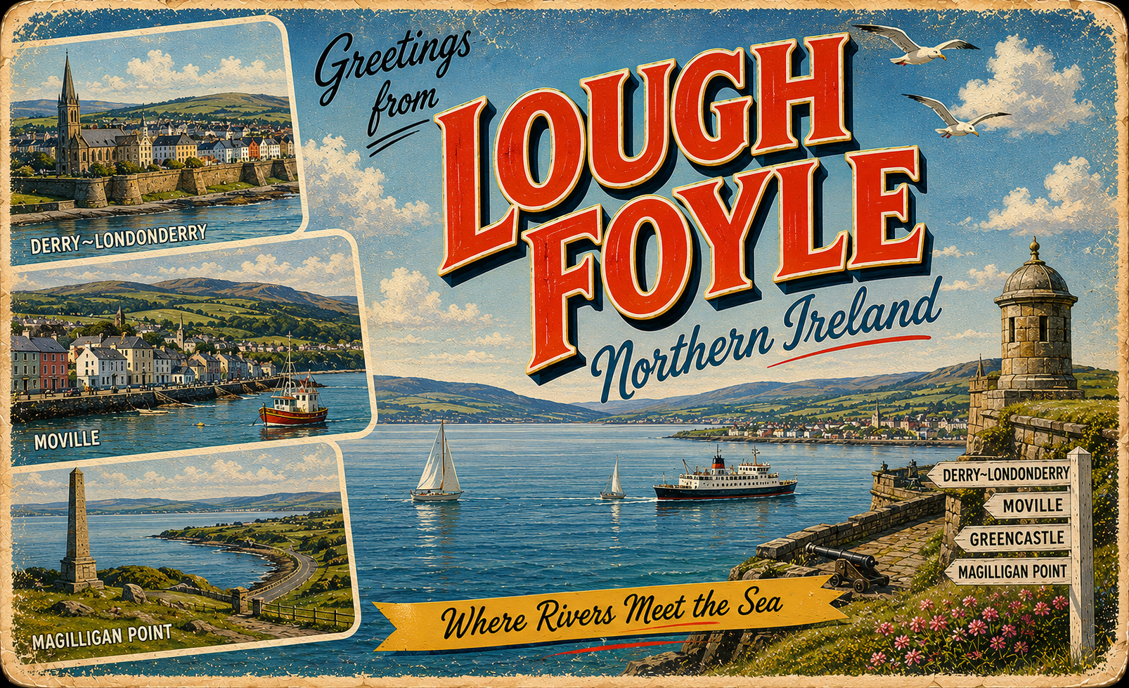
Derry/Londonderry – Inland city on the River Foyle, offering river access and a more sheltered environment upstream.
-
Greencastle – Situated near the lough entrance, often used as a reference point for coastal transitions.
-
Moville – Located along the eastern shore, with access influenced by tidal conditions and local depth variations.
-
Magilligan Point – Northern headland marking the western side of the lough entrance, exposed to open sea conditions.
Practical Mooring & Anchorage Locations
Foyle Marina, Derry/Londonderry
- Type: Marina / River Mooring
- Shelter: Well sheltered from northerly, westerly, and easterly winds within the river system
- Exposure: Southerly winds can funnel upriver; strong river flow during tidal exchanges
- Key Constraints: Significant tidal range on the River Foyle; commercial traffic in lower approaches; bridge clearance considerations
- Traffic Level: High
- Liveaboard Suitability: High
- Notes: Central and established mooring point with good access to services. Best approached with tidal timing awareness due to strong currents.
Culmore Point / Foyle Yacht Club
- Type: Marina / Yacht Club Mooring
- Shelter: Sheltered from southerly and easterly winds within the inner lough
- Exposure: Northerly and north-westerly winds can create chop in exposed reaches
- Key Constraints: Strong tidal flows on approach; limited depth outside marked channels
- Traffic Level: Medium
- Liveaboard Suitability: Medium
- Notes: Common recreational mooring area with reasonable access to Derry. Conditions vary significantly with tide state.
Greencastle Harbour
- Type: Harbour
- Shelter: Good shelter from southerly winds and moderate protection from westerlies
- Exposure: Northerly swell can enter the harbour mouth in unsettled conditions
- Key Constraints: Ferry traffic to Magilligan; strong currents at harbour entrance; swell wrapping in certain conditions
- Traffic Level: High
- Liveaboard Suitability: Medium
- Notes: Busy working harbour with regular cross-lough ferry operations. Best used with careful timing on tidal transitions.
Moville Harbour
- Type: Harbour
- Shelter: Sheltered from easterly winds; partial shelter from southerlies
- Exposure: North-westerly winds can create uncomfortable conditions in the outer basin
- Key Constraints: Shallow margins at low tide; limited berth availability; tidal dependence for access
- Traffic Level: Medium
- Liveaboard Suitability: Medium
- Notes: Small town harbour with occasional visitor berthing. Best suited for short to medium stays depending on space.
Quigley’s Point Harbour
- Type: Harbour
- Shelter: Moderate shelter from southerly winds within inner lough
- Exposure: Northerly winds can produce chop due to limited breakwater protection
- Key Constraints: Very shallow approaches at low water; limited facilities; tidal planning required
- Traffic Level: Low
- Liveaboard Suitability: Low
- Notes: Small local harbour with restricted space and depth. Generally suitable only in settled conditions or for brief stops.
Magilligan Point Anchorage
- Type: Anchorage / Exposed Mooring
- Shelter: Limited shelter; partial lee in certain easterly conditions within the inner lough edge
- Exposure: Highly exposed to north-westerly Atlantic swell and wind
- Key Constraints: Strong tidal currents near lough entrance; shifting sandbanks; exposed holding ground
- Traffic Level: Low
- Liveaboard Suitability: Low
- Notes: Used only in settled weather windows due to exposure. Requires careful monitoring of sea state and tide.
Operational Support Infrastructure (Public Services)
Healthcare
Healthcare services are available within nearby urban centres, with facilities generally located inland from the immediate shoreline.
Emergency Services
Emergency response coverage is present across the region, though response times may vary depending on location and access conditions.
Postal Services
Postal services operate through surrounding towns and settlements, with standard provision across the region.
Civic Services
Basic civic services are accessible within nearby population centres, though less so along more remote coastal stretches.
Visitor Information
Visitor information is typically available in larger towns in the surrounding area, providing general regional guidance.
Practical Notes for Boaters
This section will be developed over time based on direct experience and relevant contributions. The focus is on practical usefulness rather than completeness.
From the Project
Observations and notes from the ongoing boat conversion and coastal exploration project will be added here as they become available.
Related Knowledge Base
- Coastal erosion processes
- Sedimentary rock formations
- Harbour types and access
- Tidal patterns and coastal conditions
Status
This is part of a growing coastal index. Content will be expanded over time as the project develops.