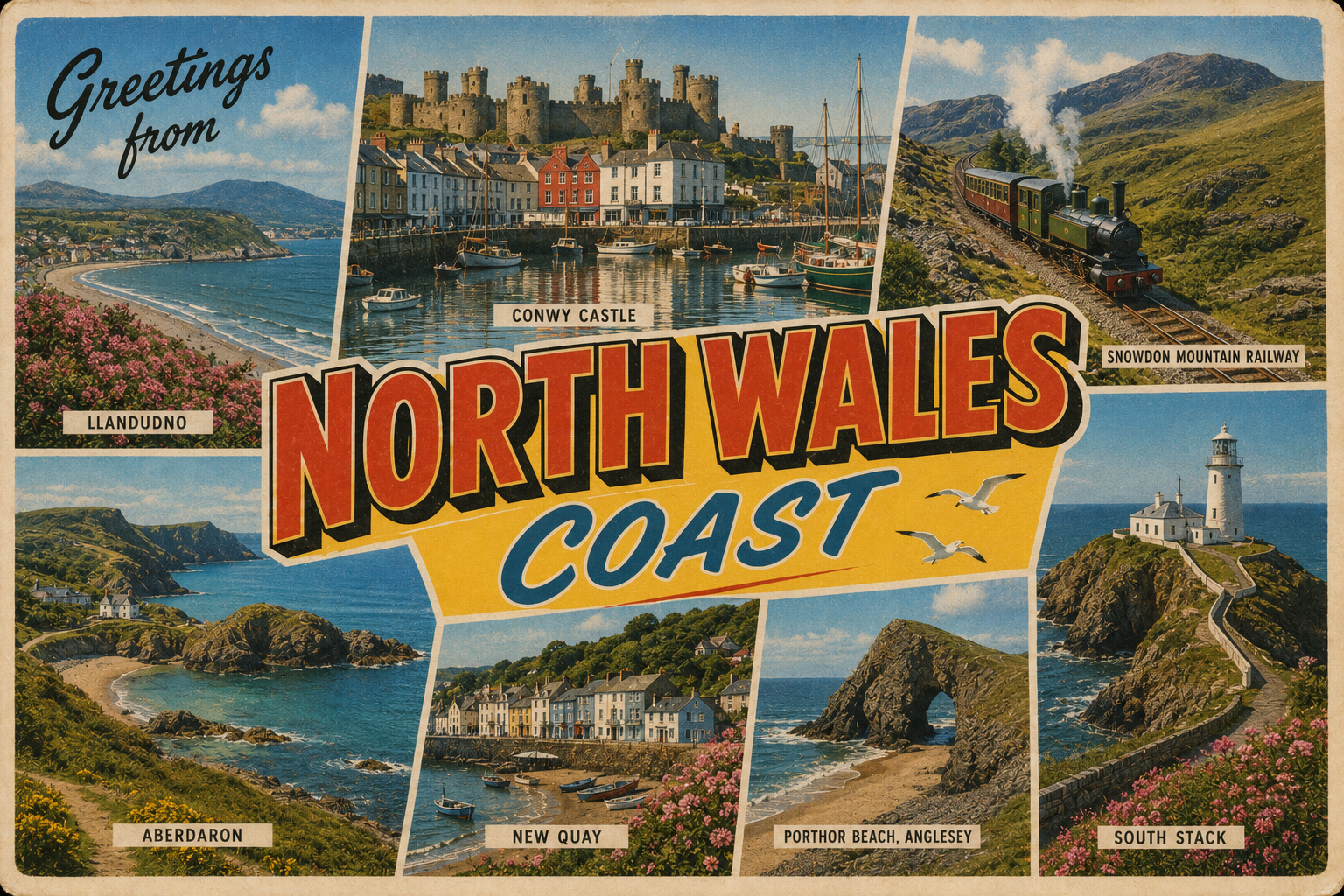
North Wales Coast
Overview
The North Wales coast extends from the Dee Estuary in the east to the Llŷn Peninsula in the west, facing the Irish Sea. It includes a varied shoreline of sandy bays, estuarine inlets, and more rugged headlands further west. Coastal settlements are interspersed with stretches of open shoreline and shallow approaches.
The area is influenced by strong tidal movements and shifting coastal conditions. Navigation often requires attention to local charts and tidal planning, particularly around estuaries and sandbanks.
Local Operating Context (for Liveaboard Boaters)
Liveaboard activity along this coast tends to be shaped by tidal access constraints and exposure to prevailing winds. Many areas dry at low water or have limited deep-water access, affecting movement and anchorage options.
Weather systems moving in from the Irish Sea can change conditions relatively quickly, with onshore winds increasing exposure along open stretches. Westerly and north-westerly winds can produce more challenging sea states.
Estuarine areas may provide temporary refuge but often require local knowledge due to shifting channels and sediment movement. Navigation aids are present but may not fully reflect recent seabed changes.
Seasonal variation is notable, with calmer conditions more common in summer months, though not assured. Winter conditions can limit access and increase risk for vessels remaining in situ.
Typical Conditions
- Large tidal ranges with strong streams in constricted areas
- Prevailing westerly winds influencing sea state
- Shallow coastal gradients with sandbanks and drying areas
- Variable visibility in changing weather systems
Access & Shelter
- Limited natural harbours with consistent deep-water access
- Estuaries may offer partial shelter depending on tide and wind direction
- Open bays can be exposed to Irish Sea conditions
- Access windows often dictated by tidal height and timing
Shore Interaction
- Access to shore may depend on tidal state, particularly in shallow areas
- Landing points can vary in suitability due to sediment and exposure
- Some coastal towns provide general access to public amenities
- Interaction with shore often requires planning around drying zones
Risk Factors
- Strong tidal currents and overfalls in certain headland areas
- Shifting sandbanks affecting navigation routes
- Exposure to rapidly changing weather from the Irish Sea
- Limited all-weather shelter along open sections of coast
Overall Character
The North Wales coast presents a mixed operating environment with periods of relative calm offset by exposure and tidal complexity. It requires a cautious and flexible approach, particularly for those relying on anchorage or tidal access. Conditions can vary significantly across relatively short distances.
Notable Locations
-
Conwy – Historic harbour area with tidal access considerations and river approach.
-
Caernarfon Bar – Known for shifting sands and requires careful timing for safe passage.
-
Holyhead – A major harbour offering more consistent shelter in varied conditions.
-
Porthmadog – Estuarine setting with shallow approaches and tidal constraints.
Practical Mooring & Anchorage Locations
Holyhead Harbour
- Type: Harbour / Marina
- Shelter: Good shelter from most directions, particularly westerly and southerly winds.
- Exposure: Strong easterlies can create uncomfortable conditions in outer harbour areas.
- Key Constraints: Heavy commercial ferry traffic and harbour control requirements. Strong tidal streams outside harbour approaches.
- Traffic Level: High
- Liveaboard Suitability: High
- Notes: One of the few major all-weather refuges on this coast. Marina and harbour facilities are well established.
Conwy Harbour
- Type: Harbour / River Mooring
- Shelter: Reasonable shelter within the river from westerly and south-westerly winds.
- Exposure: Entrance and outer moorings exposed during strong northerly conditions.
- Key Constraints: Tidal access limitations and shifting sandbanks at the entrance. Careful pilotage required on approach.
- Traffic Level: Medium
- Liveaboard Suitability: Medium
- Notes: Visitor and local moorings available within the estuary. Access windows reduce flexibility for deeper draft vessels.
Caernarfon Harbour
- Type: Harbour / River Mooring
- Shelter: Good shelter upriver from most wind directions.
- Exposure: Outer approaches exposed to north-westerly sea conditions.
- Key Constraints: Access over Caernarfon Bar is tidal and channel positions can shift. Strong tidal flows through the Menai Strait.
- Traffic Level: Medium
- Liveaboard Suitability: Medium
- Notes: Frequently used staging and shelter point for local cruising. Local tidal knowledge is important.
Porthmadog Harbour
- Type: Harbour / Estuary Mooring
- Shelter: Sheltered within the estuary from most offshore winds.
- Exposure: Entrance channel and outer estuary uncomfortable in strong westerlies.
- Key Constraints: Shallow and drying approaches with significant tidal limitations. Navigation channels can alter after storms.
- Traffic Level: Medium
- Liveaboard Suitability: Low
- Notes: Better suited to shoal-draft vessels familiar with estuary navigation. Extended stays depend heavily on tide access.
Pwllheli Marina
- Type: Marina
- Shelter: Well protected from prevailing westerly and south-westerly conditions.
- Exposure: Some surge possible during strong northerly weather offshore.
- Key Constraints: Marina access subject to dredged channel conditions and tidal considerations for deeper vessels.
- Traffic Level: Medium
- Liveaboard Suitability: High
- Notes: One of the more practical long-term marina bases in the region. Facilities and shore access are comparatively reliable.
Deganwy Marina
- Type: Marina
- Shelter: Sheltered within the Conwy estuary from most wind directions.
- Exposure: Outer estuary can become uncomfortable in strong northerlies.
- Key Constraints: Tidal depth restrictions near entrance and estuary channel considerations.
- Traffic Level: Medium
- Liveaboard Suitability: Medium
- Notes: More controlled access environment than harbour moorings nearby. Tidal planning remains necessary for some vessels.
Operational Support Infrastructure (Public Services)
Healthcare
Healthcare services are available in larger coastal towns and regional centres, with hospitals and clinics distributed inland as well as near the coast.
Emergency Services
Emergency response coverage includes coastguard services and lifeboat stations positioned along the coastline, supported by national emergency infrastructure.
Postal Services
Postal services operate through standard national networks, accessible in most towns and settlements along the coast.
Civic Services
Local authorities provide general civic services including waste management, transport links, and administrative support in populated areas.
Visitor Information
Visitor information is typically available in larger towns, offering general guidance on the area, though marine-specific details may be limited.
Practical Notes for Boaters
This section will be developed over time based on direct experience and relevant contributions. The focus is on practical usefulness rather than completeness.
From the Project
Observations and notes from the ongoing boat conversion and coastal exploration project will be added here as they become available.
Related Knowledge Base
- Coastal erosion processes
- Sedimentary rock formations
- Harbour types and access
- Tidal patterns and coastal conditions
Status
This is part of a growing coastal index. Content will be expanded over time as the project develops.