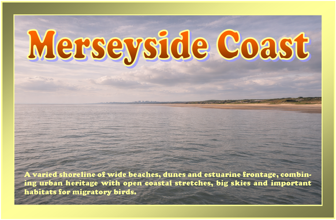
Merseyside Coast
Overview
The Merseyside coast lies along the eastern edge of Liverpool Bay, centred on the wide estuary of the River Mersey. It includes a mix of urban waterfront, industrial stretches, and more open coastal frontage extending north and south of the estuary mouth.
This is a heavily influenced tidal environment, with strong flows and significant commercial traffic in parts. Conditions can vary notably between the inner estuary and more exposed coastal areas, requiring careful attention to timing and navigation.
Local Operating Context (for Liveaboard Boaters)
Navigation within the Mersey estuary is shaped by large tidal ranges and fast-moving currents. Planning around tidal windows is often necessary, particularly when entering or leaving more sheltered waters.
Traffic density may be higher than in less urbanised coastal regions, with large vessels using defined channels. Smaller craft typically operate with caution and maintain awareness of shipping movements.
Shore access opportunities vary, with some stretches dominated by infrastructure and limited landing options. Elsewhere, more open beaches and quieter areas may allow for occasional access, depending on conditions.
Weather exposure increases significantly outside the estuary, where Liverpool Bay can present choppy and unsettled conditions, especially with onshore winds.
Typical Conditions
- Strong tidal currents, particularly within the estuary
- Large tidal range with extensive mudflats at low water
- Variable wind exposure, often more pronounced in open bay areas
- Frequent commercial vessel movement in designated channels
Access & Shelter
- Shelter within the estuary can be variable and dependent on position and tide
- Open coastal stretches offer limited natural protection
- Entry and exit points often require tidal consideration
- Some areas may become inaccessible at low water due to shallow approaches
Shore Interaction
- Urban waterfront areas may restrict informal landing
- Beaches and foreshore areas provide occasional access where conditions allow
- Strong tides can complicate safe approach to shore
- Care is needed around soft mud in exposed estuary zones
Risk Factors
- Fast tidal streams with potential for rapid drift
- Commercial shipping traffic requiring vigilance
- Shallow areas and shifting sandbanks in parts of the bay
- Exposure to wind-driven waves outside sheltered zones
Overall Character
The Merseyside coast presents a mixed operating environment combining busy estuarine navigation with more exposed coastal waters. It is functional rather than remote, with conditions that often depend on tide, weather, and traffic patterns.
Notable Locations
-
Liverpool – central waterfront along the estuary, with controlled navigation and heavy vessel movement.
-
New Brighton – coastal frontage near the estuary mouth, often exposed to conditions from Liverpool Bay.
-
Formby Point – open sandy coastline to the north, with shifting sands and limited shelter.
-
River Mersey Estuary – broad tidal inlet with strong currents and defined navigation channels.
Practical Mooring & Anchorage Locations
Liverpool Marina (Coburg Dock)
- Type: Marina
- Shelter: Fully sheltered from all wind directions within enclosed dock system
- Exposure: Minimal internal exposure; wave action only possible during lock movements
- Key Constraints: Lock access dependent on tidal state and marina operating procedures; berth availability may be limited
- Traffic Level: High
- Liveaboard Suitability: High
- Notes: Established residential marina within Liverpool docks. Strong urban infrastructure and services nearby.
Salthouse Dock / Liverpool Waterfront Docks
- Type: Marina
- Shelter: Well sheltered within enclosed dock basin
- Exposure: Low exposure; occasional wash from lock operations and nearby vessel movement
- Key Constraints: Controlled access via dock system; visitor berths limited and regulated; tidal lock scheduling required
- Traffic Level: High
- Liveaboard Suitability: Medium
- Notes: Central waterfront location with strong protection but limited long-stay capacity for smaller craft.
Crosby Lakeside Marina (Marine Lake)
- Type: Marina
- Shelter: Fully sheltered within inland marine lake
- Exposure: Very low; no direct sea state exposure
- Key Constraints: Access restricted by tidal gate system; depth and usage rules apply within marine lake
- Traffic Level: Medium
- Liveaboard Suitability: Medium
- Notes: Stable and protected environment suitable for small craft mooring. Not directly representative of open coastal conditions.
Southport Marina / Marine Lake
- Type: Marina
- Shelter: Highly sheltered within marine lake system
- Exposure: Very low within lake; exposed conditions possible on outer Ribble estuary approach
- Key Constraints: Tidal gate operations control water levels; access timing required for entry and exit
- Traffic Level: Medium
- Liveaboard Suitability: Medium
- Notes: Suitable for longer stays in calm conditions. External estuary area should be treated as exposed and fast-changing.
Eastham Ferry (River Mersey Mooring Area)
- Type: River Mooring
- Shelter: Moderate shelter depending on tide and position within the river bend
- Exposure: Exposed to strong tidal currents and passing vessel wash
- Key Constraints: Significant tidal range and fast streams; limited formal mooring infrastructure; depth variability
- Traffic Level: Medium
- Liveaboard Suitability: Low
- Notes: Occasional stopping point rather than long-term mooring option. Conditions change rapidly with tide.
West Kirby Marine Lake
- Type: Marina / Tidal Marine Lake
- Shelter: Fully sheltered when gates are closed
- Exposure: None inside lake; exposed when gates are open to tidal exchange
- Key Constraints: Strict gate operation times; shallow depth in parts; usage primarily recreational
- Traffic Level: Medium
- Liveaboard Suitability: Low
- Notes: Controlled environment suitable for small craft use. Not designed for extended liveaboard or offshore cruising vessels.
Operational Support Infrastructure (Public Services)
Healthcare
Healthcare services are available within the surrounding urban areas, with hospitals and clinics accessible from multiple points along the coast.
Emergency Services
Emergency response coverage is well established across the region, including coastal and maritime support coordinated through standard UK services.
Postal Services
Postal facilities are widely available within nearby towns and city districts along the Merseyside coastline.
Civic Services
Local authorities provide standard civic services across the coastal settlements, including waste management and public amenities in accessible areas.
Visitor Information
Visitor information can be found within larger settlements, offering general guidance on the area and its coastal environment.
Practical Notes for Boaters
This section will be developed over time based on direct experience and relevant contributions. The focus is on practical usefulness rather than completeness.
From the Project
Observations and notes from the ongoing boat conversion and coastal exploration project will be added here as they become available.
Related Knowledge Base
- Coastal erosion processes
- Sedimentary rock formations
- Harbour types and access
- Tidal patterns and coastal conditions
Status
This is part of a growing coastal index. Content will be expanded over time as the project develops.